 vesseltracker.com
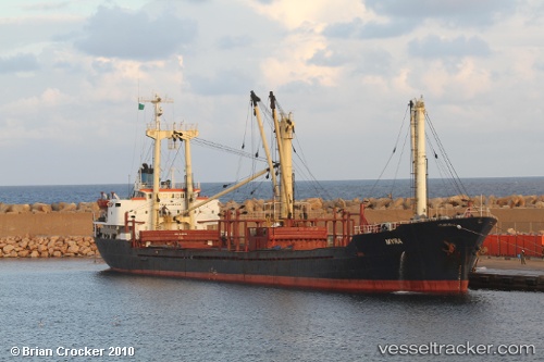
Vessel Amal Neptune IMO: 8116843, MMSI: 677042400 General Cargo Ship
UTC, 25.82933, 55.32593, course: 35, speed: 7.3
UTC, 25.82933, 55.32593, course: 35, speed: 7.3
2026-01-30 04:51:18 UTC, 26.29115, 55.74329, course: 38, speed: 7.2
Live AIS position:
UTC. 21 nm NW of Hulaylah Terminal),
updated 2026-01-30 04:51:18 UTC.
Find the position of the vessel Amal Neptune on the map. The latter are known coordinates and path.
marine traffic ship tracker show on live map
The current position of vessel Amal Neptune is 26.29115 lat / 55.74329 lng. Updated: 2026-01-30 04:51:18 UTCCurrently sailing under the flag of Tanzania
Amal Neptune built in 1981 year
Deadweight:
6471 tDetails:
Last coordinates of the vessel:
UTC, 25.82933, 55.32593, course: 35, speed: 7.3UTC, 25.82933, 55.32593, course: 35, speed: 7.3
UTC, 25.82933, 55.32593, course: 35, speed: 7.3
2026-01-30 04:51:18 UTC, 26.29115, 55.74329, course: 38, speed: 7.2