 vesseltracker.com
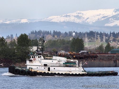
Taku Wind
Current StatusWhere is the vessel?
Taku Wind is currently in Near Satellite Beach, based on AIS data received about 2h ago.
Latest AIS update:
Current position: 28.20497° N, 80.58296° W (Near Satellite Beach)
Average speed (last 7 days): Loading…
Average speed (last 30 days): Loading…
Vessel profile: Taku Wind is a Tug with dimensions 10m x 35m.
This page combines live AIS, route history, probable destination signals, nearby traffic, and port activity for practical vessel monitoring.
The current position of vessel Taku Wind is 28.20497 lat / -80.58296 lng. Updated: 2026-03-25 14:26:37 UTCNearest reference points:
- Near Indian Harbour Beach
- Near Port Canaveral
- Near Indian River City
Details:
Live Vessel Taku Wind Analytics (details, animations, etc.)
Recent AIS points (UTC):
2026-03-25 07:52:30 UTC · 28.40892, -80.62150 · SOG 0 kn · COG 97°2026-03-25 09:52:29 UTC · 28.40890, -80.62153 · SOG 0 kn · COG 95°
2026-03-25 11:22:30 UTC · 28.40890, -80.62156 · SOG 0 kn · COG 92°
2026-03-25 14:26:37 UTC · 28.20497, -80.58296 · SOG 9.9 kn · COG 176°