 vesseltracker.com
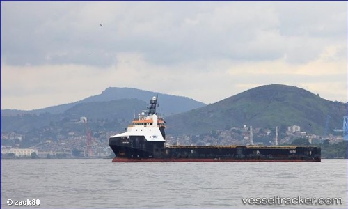
Vessel Alcatraz IMO: 9644146, MMSI: 710000698 Offshore Tug Supply Ship
UTC, -24.48078, -44.22150, course: 243, speed: 0.2
UTC, -24.48061, -44.22305, course: 261, speed: 0.5
2026-01-31 03:29:11 UTC, -24.49039, -44.22137, course: 261, speed: 0.5
Live AIS position:
UTC. 75 nm SE of Sao Sebastiao),
updated 2026-01-31 03:29:11 UTC.
Find the position of the vessel Alcatraz on the map. The latter are known coordinates and path.
marine traffic ship tracker show on live map
The current position of vessel Alcatraz is -24.49039 lat / -44.22137 lng. Updated: 2026-01-31 03:29:11 UTCDetails:
Last coordinates of the vessel:
UTC, -24.48457, -44.21896, course: 235, speed: 0.1UTC, -24.48078, -44.22150, course: 243, speed: 0.2
UTC, -24.48061, -44.22305, course: 261, speed: 0.5
2026-01-31 03:29:11 UTC, -24.49039, -44.22137, course: 261, speed: 0.5