 vesseltracker.com
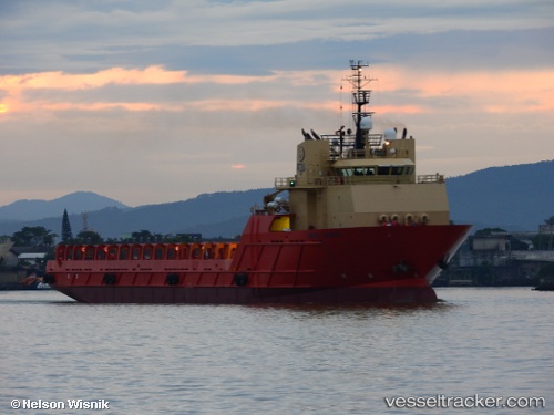
Vessel Bram Bahia IMO: 9620308, MMSI: 710006970 Offshore Tug Supply Ship
UTC, -21.85612, -40.94105, course: 15, speed: 0.1
UTC, -21.85627, -40.94069, course: 11, speed: 0.2
2026-02-04 10:15:55 UTC, -21.85630, -40.94049, course: 27, speed: 0.1
Live AIS position:
UTC. Near Açu Pt/São João da Barra),
updated 2026-02-04 10:15:55 UTC.
Find the position of the vessel Bram Bahia on the map. The latter are known coordinates and path.
marine traffic ship tracker show on live map
The current position of vessel Bram Bahia is -21.85630 lat / -40.94049 lng. Updated: 2026-02-04 10:15:55 UTCDetails:
Last coordinates of the vessel:
UTC, -21.85963, -41.01986, course: 61, speed: 0.3UTC, -21.85612, -40.94105, course: 15, speed: 0.1
UTC, -21.85627, -40.94069, course: 11, speed: 0.2
2026-02-04 10:15:55 UTC, -21.85630, -40.94049, course: 27, speed: 0.1