 vesseltracker.com
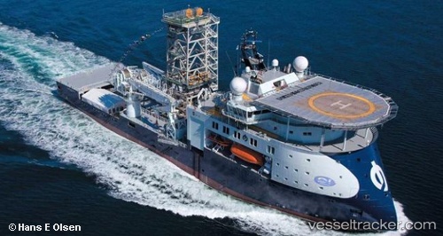
Vessel ISLAND INTERVENTION IMO: 9460095, MMSI: 710008574 Well Stimulation Vessel
UTC, -22.87047, -43.12282, course: 225, speed: 0
UTC, -22.87045, -43.12280, course: 225, speed: 0
2026-03-03 05:32:49 UTC, -22.87047, -43.12282, course: 225, speed: 0
Live AIS position:
UTC. Near NITEROI),
updated 2026-03-03 05:32:49 UTC.
Find the position of the vessel ISLAND INTERVENTION on the map. The latter are known coordinates and path.
marine traffic ship tracker show on live map
The current position of vessel ISLAND INTERVENTION is -22.87047 lat / -43.12282 lng. Updated: 2026-03-03 05:32:49 UTCDetails:
Last coordinates of the vessel:
UTC, -22.87050, -43.12283, course: 225, speed: 0UTC, -22.87047, -43.12282, course: 225, speed: 0
UTC, -22.87045, -43.12280, course: 225, speed: 0
2026-03-03 05:32:49 UTC, -22.87047, -43.12282, course: 225, speed: 0