 vesseltracker.com
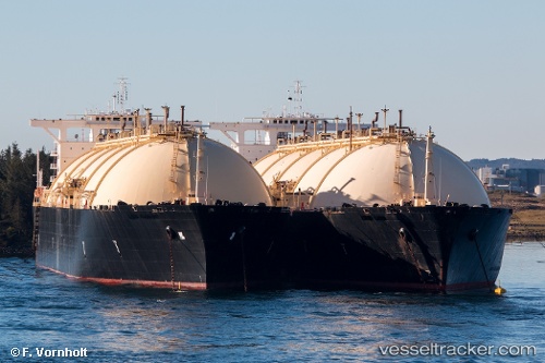
Find the position of the vessel BERING ENERGY on the map. The latter are known coordinates and path.
marine traffic ship tracker show on live map
The current position of vessel BERING ENERGY is -29.6597 lat / 12.4359 lng. Updated: 2024-04-19 22:34:07 UTCCurrently sailing under the flag of Marshall Islands
BERING ENERGY built in 1978 year
Deadweight:
72555 tGross tonnage:
95084Service entry:
1978-01-01T00:00:00ZDetails:
Last coordinates of the vessel:
UTC, -29.6597, 12.4359, course: 317, speed: 15.6UTC, -29.6597, 12.4359, course: 317, speed: 15.6
UTC, -29.6597, 12.4359, course: 317, speed: 15.6
UTC, -29.6597, 12.4359, course: 317, speed: 15.6
2024-04-19 22:34:07 UTC, -29.6597, 12.4359, course: 317, speed: 15.6