 vesseltracker.com
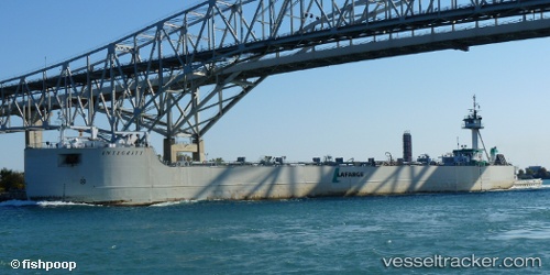
Find the position of the vessel Gl Ostrander on the map. The latter are known coordinates and path.
marine traffic ship tracker show on live map
The current position of vessel Gl Ostrander is 45.0667 lat / -83.4067 lng. Updated: 2024-04-29 10:07:35 UTCCurrently sailing under the flag of USA
Gl Ostrander built in 1976 year
Gross tonnage:
783Service entry:
1976-01-01T00:00:00ZDetails:
Last coordinates of the vessel:
UTC, 45.0667, -83.4067, course: -1, speed: 0UTC, 45.0667, -83.4067, course: -1, speed: 0
UTC, 45.0667, -83.4067, course: -1, speed: 0
2024-04-29 10:07:35 UTC, 45.0667, -83.4067, course: -1, speed: 0