 vesseltracker.com
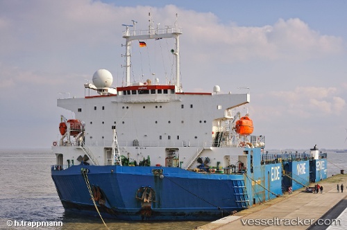
Find the position of the vessel SMURF on the map. The latter are known coordinates and path.
marine traffic ship tracker show on live map
The current position of vessel SMURF is 30.3967 lat / 49.0133 lng. Updated: 2024-05-04 13:39:11 UTCCurrently sailing under the flag of St.Kitts and Nevis
SMURF built in 1975 year
Deadweight:
9748 tService entry:
1978-01-01T00:00:00ZManufacturer:
Uraga Dock Company (Japanese shipyard)Details:
Last coordinates of the vessel:
UTC, 30.282, 48.9116, course: 330, speed: 6.2UTC, 30.2917, 48.9033, course: -1, speed: 6
UTC, 30.4067, 48.9584, course: 109, speed: 6.2
2024-05-04 13:39:11 UTC, 30.3967, 49.0133, course: -1, speed: 5