 vesseltracker.com
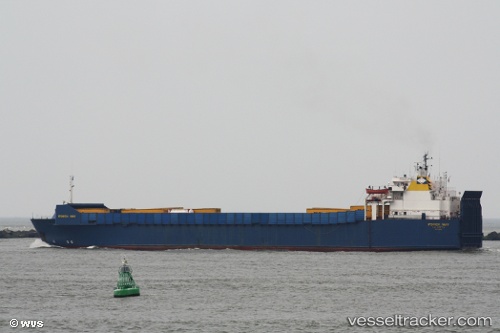
Find the position of the vessel Istanbul N on the map. The latter are known coordinates and path.
marine traffic ship tracker show on live map
The current position of vessel Istanbul N is 40.3792 lat / 27.956 lng. Updated: 2024-04-27 07:52:51 UTCCurrently sailing under the flag of Turkey
Istanbul N built in 1980 year
Port of registry:
Istanbul (city in Turkey located at the Bosporus Strait)Deadweight:
4550 tService entry:
1980-01-01T00:00:00ZManufacturer:
Karlskrona shipyard (naval shipyard in Sweden)Details:
Last coordinates of the vessel:
UTC, 40.3791, 27.9567, course: 45, speed: 0.4UTC, 40.379, 27.9565, course: 29, speed: 0.6
UTC, 40.3789, 27.9564, course: 24, speed: 0.8
2024-04-27 07:52:51 UTC, 40.3792, 27.956, course: 59, speed: 0.2