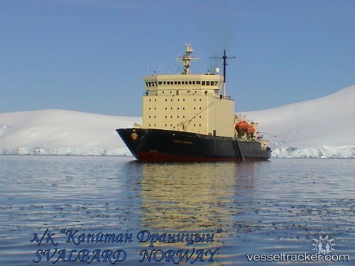
Find the position of the vessel KAPITAN DRANITSYN on the map. The latter are known coordinates and path.
marine traffic ship tracker show on live map
The current position of vessel KAPITAN DRANITSYN is 43.0769 lat / 131.869 lng. Updated: 2025-06-28 23:11:07 UTCCurrently sailing under the flag of Russia
KAPITAN DRANITSYN built in 1980 year
Deadweight:
4515 tDetails:
Last coordinates of the vessel:
UTC, 43.0769, 131.869, course: 282, speed: 3.3UTC, 43.0769, 131.869, course: 282, speed: 3.3
UTC, 43.0769, 131.869, course: 282, speed: 3.3
2025-06-28 23:11:07 UTC, 43.0769, 131.869, course: 282, speed: 3.3
The ship also appears on the maps:
- All icebreakers in one map
- ТЫК2021
- NSR 2021.12.01
- NSR 2021.12.01
- NSR 2021.12.01
- NSR 2021.12.01
- NSR 2021.12.01
- NSR 07.12.2021
- Доставка грузов в морской порт Певек
- Северный Морской Путь 2022
- СМП-22
- СМП-2
- СМП-22/02
- Northern Sea Route. General Cargo Ships & Russian icebreakers
- AVM_1_FEB_2022
- Урарту - Драницын
- Бухта енисей
- СМП-2022
- СМП-2022 (от 24.06.2022)
- СМП-2022 (04.07.2022)
- СМП-2022 (06.07.2022)
- СМП-2022 (10.07.2022)
- Autumn2022
- Ледоколы СМП (период зимне-весенней навигации 2022-2023 годов)
- Северная звезда
- Карта путей северного потока. Росморпорт. Ледоколы.
- NSR Permits 2024
- ПАСИФИК ЛАЙНЗ
- ПАСИФИК ЛАЙНЗ - 1
- Полар не один
- Манорский
- Манорский
- демобилизация 1
- Демобилизация 1 рейс
- Полар в пути

 vesseltracker.com