 vesseltracker.com
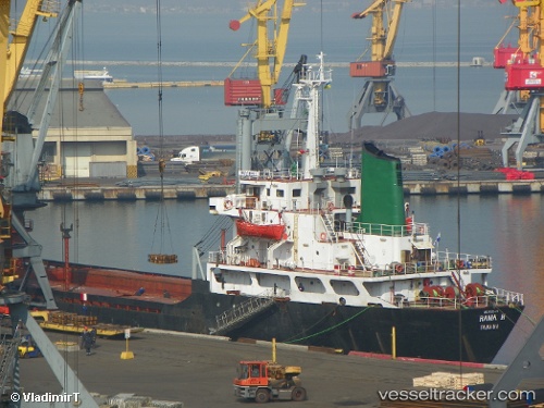
Find the position of the vessel RAMA H on the map. The latter are known coordinates and path.
marine traffic ship tracker show on live map
The current position of vessel RAMA H is 45.3457 lat / 28.3289 lng. Updated: 2024-05-03 20:58:01 UTCCurrently sailing under the flag of Honduras
RAMA H built in 1982 year
Deadweight:
8214 tGross tonnage:
5241Service entry:
1982-01-01T00:00:00ZDetails:
Last coordinates of the vessel:
UTC, 45.3457, 28.3289, course: 333, speed: 0UTC, 45.3457, 28.3289, course: 333, speed: 0
UTC, 45.3457, 28.3289, course: 333, speed: 0
2024-05-03 20:58:01 UTC, 45.3457, 28.3289, course: 333, speed: 0