 vesseltracker.com
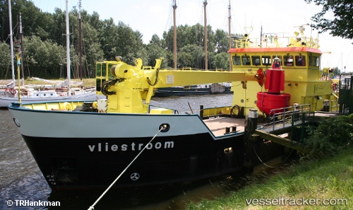
 VLIESTROOM
Current Status
Where is the vessel?
VLIESTROOM is currently in Near Wilhelmshaven, based on AIS data received about 2h ago.
Latest AIS update:
Current position: 53.52867° N, 8.14932° E (Near Wilhelmshaven)
Average speed (last 7 days): Loading…
Average speed (last 30 days): Loading…
Vessel profile: VLIESTROOM is a Tender with dimensions m x m.
This page combines live AIS, route history, probable destination signals, nearby traffic, and port activity for practical vessel monitoring.
The current position of vessel VLIESTROOM is 53.52867 lat / 8.14932 lng. Updated: 2026-03-25 23:41:55 UTCNearest reference points:
- Near Wilhelmshaven
- Near HOOKSIEL
- Near Horumersiel
Currently sailing under the flag of Netherlands ![]()
Details:
Live Vessel VLIESTROOM Analytics (details, animations, etc.)
Recent AIS points (UTC):
2026-03-25 18:20:48 UTC · 53.52867, 8.14932 · SOG 0 kn · COG 182°2026-03-25 19:33:03 UTC · 53.52866, 8.14932 · SOG 0 kn · COG 182°
2026-03-25 21:35:57 UTC · 53.52866, 8.14932 · SOG 0 kn · COG 182°
2026-03-25 23:41:55 UTC · 53.52867, 8.14932 · SOG 0 kn · COG 182°