vessel Fd283 Trui Uan Hinte IMO: 8816120, Fishing Vessel
vesseltracker.com
Vessel Fd283 Trui Uan Hinte IMO: 8816120, Fishing Vessel
MMSI: 235007860 callsign: MFTX2 size: 40x40

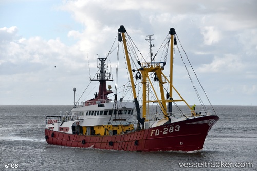
Find the position of the vessel Fd283 Trui Uan Hinte on the map. The latter are known coordinates and path.

marine traffic ship tracker show on live map

The current position of vessel Fd283 Trui Uan Hinte is 55.3974 lat / 4.05167 lng. Updated: 2024-04-29 17:48:41 UTC

Currently sailing under the flag of United Kingdom

Fd283 Trui Uan Hinte built in 1989 year

Details:


Last coordinates of the vessel:
UTC, 55.2467, 3.71677, course: 59, speed: 6.2
UTC, 55.2717, 3.77167, course: -1, speed: 6
UTC, 55.3414, 3.92796, course: 52, speed: 6.1
2024-04-29 17:48:41 UTC, 55.3974, 4.05167, course: 53, speed: 6.1


Most frequent ports a vessels calls at Fd283 Trui Uan Hinte (235007860):

Lowestoft, traffic: 5
Ijmuiden, traffic: 3
Den Helder, traffic: 2

Link to the map:


Find another ship

Fd283_Trui_Uan_Hinte (235007860) last ports (portcalls and passsages)

Ijmuiden | 2024-03-29 10:29:18
Lowestoft | 2024-03-05 07:55:41
Lowestoft | 2023-09-21 08:44:49
Ijmuiden | 2023-06-30 07:31:06
Ijmuiden | 2023-06-26 06:28:19
Lowestoft | 2023-03-08 11:45:42
Den Helder | 2023-02-09 03:17:08
Den Helder | 2023-02-04 23:47:31
Lowestoft | 2022-09-15 07:37:35
Lowestoft | 2022-03-17 09:45:18