 vesseltracker.com
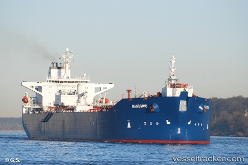
Find the position of the vessel Randgrid on the map. The latter are known coordinates and path.
marine traffic ship tracker show on live map
The current position of vessel Randgrid is 58.583 lat / 1.72918 lng. Updated: 2024-05-02 20:17:22 UTCPort of registry:
Nassau (capital city of the Commonwealth of the Bahamas)Gross tonnage:
76824Service entry:
1995-01-01T00:00:00ZManufacturer:
Samsung Heavy Industries (South Korean shipbuilding company)Details:
Last coordinates of the vessel:
UTC, 58.5828, 1.72937, course: 69, speed: 0UTC, 58.5827, 1.72938, course: 68, speed: 0
UTC, 58.5827, 1.72938, course: 68, speed: 0
2024-05-02 20:17:22 UTC, 58.583, 1.72918, course: 79, speed: 0