 vesseltracker.com
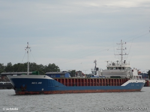
Neuland
Current StatusWhere is the vessel?
Neuland is currently in 12 nm SE of HELGOLAND, based on AIS data received about 1h ago.
Latest AIS update:
Current position: 54.06960° N, 8.17965° E (12 nm SE of HELGOLAND)
Average speed (last 7 days): Loading…
Average speed (last 30 days): Loading…
Vessel profile: Neuland is a Multi Purpose Carrier with dimensions 12m x 89m.
This page combines live AIS, route history, probable destination signals, nearby traffic, and port activity for practical vessel monitoring.
The current position of vessel Neuland is 54.0696 lat / 8.17965 lng. Updated: 2026-03-26 04:02:52 UTCNearest reference points:
- 10 nm E of Wangerooge
- Near Wangerooge
- Near HOOKSIEL
Details:
Live Vessel Neuland Analytics (details, animations, etc.)
Recent AIS points (UTC):
2026-03-25 21:36:59 UTC · 54.12640, 8.86476 · SOG 0 kn · COG 233°2026-03-25 23:39:43 UTC · 54.12500, 8.86333 · SOG 0 kn · COG -1°
2026-03-26 01:39:08 UTC · 54.10950, 8.64706 · SOG 6.8 kn · COG 250°
2026-03-26 04:02:52 UTC · 54.06960, 8.17965 · SOG 6.8 kn · COG 263°