 vesseltracker.com
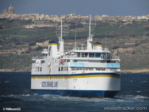
Find the position of the vessel Ta Pinu on the map. The latter are known coordinates and path.
marine traffic ship tracker show on live map
The current position of vessel Ta Pinu is 36.0233 lat / 14.3046 lng. Updated: 2024-05-04 17:36:31 UTCCurrently sailing under the flag of Malta
Ta Pinu built in 2000 year
Port of registry:
Valletta (capital of Malta)Deadweight:
1064 tGross tonnage:
4893Service entry:
2000-01-01T00:00:00ZManufacturer:
Malta Shipbuilding (former shipyard in Marsa, Malta)Details:
Last coordinates of the vessel:
UTC, 35.9896, 14.3296, course: 52, speed: 0UTC, 36.0233, 14.3046, course: 331, speed: 10.1
UTC, 36.0233, 14.3046, course: 331, speed: 10.1
2024-05-04 17:36:31 UTC, 36.0233, 14.3046, course: 331, speed: 10.1