 vesseltracker.com
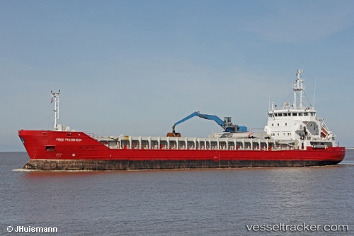
 Feed Trondheim
Current Status
Where is the vessel?
Feed Trondheim is currently in 13 nm SW of Hellvik, based on AIS data received about 2h ago.
Latest AIS update:
Current position: 58.27950° N, 5.66833° E (13 nm SW of Hellvik)
Average speed (last 7 days): Loading…
Average speed (last 30 days): Loading…
Vessel profile: Feed Trondheim is a Multi Purpose Carrier with dimensions 100m x 16m.
This page combines live AIS, route history, probable destination signals, nearby traffic, and port activity for practical vessel monitoring.
The current position of vessel Feed Trondheim is 58.27950 lat / 5.66833 lng. Updated: 2026-03-25 14:17:45 UTCNearest reference points:
- Near Egersund
- Near Lura
- Near Åna-Sira
Currently sailing under the flag of Antigua Barbuda ![]()
Feed Trondheim built in 2002 year
Deadweight:
4633 tDetails:
Live Vessel Feed Trondheim Analytics (details, animations, etc.)
Recent AIS points (UTC):
2026-03-25 07:42:35 UTC · 57.64233, 5.90750 · SOG 6.6 kn · COG 348°2026-03-25 09:25:15 UTC · 57.82583, 5.84467 · SOG 6.6 kn · COG 339°
2026-03-25 11:43:04 UTC · 58.05367, 5.72333 · SOG 6.6 kn · COG 343°
2026-03-25 14:17:45 UTC · 58.27950, 5.66833 · SOG 6.2 kn · COG 337°