 vesseltracker.com
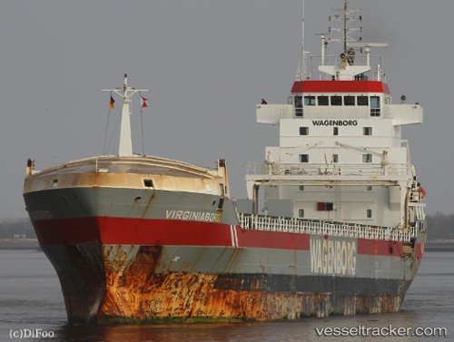
 Virginiaborg
Current Status
Where is the vessel?
Virginiaborg is currently in 20 nm N of Harvaluoto, based on AIS data received about 1h ago.
Latest AIS update:
Current position: 60.70070° N, 20.43974° E (20 nm N of Harvaluoto)
Average speed (last 7 days): Loading…
Average speed (last 30 days): Loading…
Vessel profile: Virginiaborg is a General Cargo Ship with dimensions 132m x 16m.
This page combines live AIS, route history, probable destination signals, nearby traffic, and port activity for practical vessel monitoring.
The current position of vessel Virginiaborg is 60.70070 lat / 20.43974 lng. Updated: 2026-03-25 15:42:17 UTCNearest reference points:
- Near Finström
- Near Maarianhamina (Mariehamn)
- Near MARIEHAMN
Currently sailing under the flag of Netherlands ![]()
Virginiaborg built in 2001 year
Deadweight:
9600 tDetails:
Live Vessel Virginiaborg Analytics (details, animations, etc.)
Recent AIS points (UTC):
2026-03-25 09:26:56 UTC · 60.01679, 19.38250 · SOG 11.9 kn · COG 317°2026-03-25 11:43:47 UTC · 60.41245, 19.04089 · SOG 12.3 kn · COG 7°
2026-03-25 14:14:47 UTC · 60.66028, 19.85748 · SOG 12 kn · COG 81°
2026-03-25 15:42:17 UTC · 60.70070, 20.43974 · SOG 11.7 kn · COG 91°