 vesseltracker.com
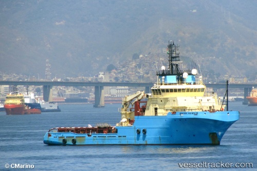
 SAINT MARTIN
Current Status
Where is the vessel?
SAINT MARTIN is currently in Near Dunkerque, based on AIS data received about 1h ago.
Latest AIS update:
Current position: 51.04494° N, 2.35796° E (Near Dunkerque)
Average speed (last 7 days): Loading…
Average speed (last 30 days): Loading…
Vessel profile: SAINT MARTIN is a Anchor Handling Vessel with dimensions m x m.
This page combines live AIS, route history, probable destination signals, nearby traffic, and port activity for practical vessel monitoring.
The current position of vessel SAINT MARTIN is 51.04494 lat / 2.35796 lng. Updated: 2026-03-25 18:21:08 UTCNearest reference points:
- Near Dunkerque
- Near ARQUES
- Near Lombardsijde
Details:
Live Vessel SAINT MARTIN Analytics (details, animations, etc.)
Recent AIS points (UTC):
2026-03-25 11:42:00 UTC · 51.04496, 2.35800 · SOG 0 kn · COG 41°2026-03-25 14:15:08 UTC · 51.04499, 2.35793 · SOG 0 kn · COG 40°
2026-03-25 15:48:00 UTC · 51.04498, 2.35793 · SOG 0 kn · COG 40°
2026-03-25 18:21:08 UTC · 51.04494, 2.35796 · SOG 0 kn · COG 41°