vessel Eneos Breeze IMO: 9259355, Crude Oil Tanker
vesseltracker.com
Vessel Eneos Breeze IMO: 9259355, Crude Oil Tanker
MMSI: 354451000 callsign: HPLK size: 60x333

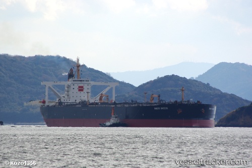
Find the position of the vessel Eneos Breeze on the map. The latter are known coordinates and path.

marine traffic ship tracker show on live map

The current position of vessel Eneos Breeze is 24.594 lat / 56.7225 lng. Updated: 2024-05-04 19:25:43 UTC
Payload_mass:
301013 tonne
Gross tonnage:
159909
Service entry:
2003-01-01T00:00:00Z

Manufacturer:
IHI Marine United
Details:


Last coordinates of the vessel:
UTC, 24.5937, 56.722, course: 142, speed: 0
UTC, 24.5938, 56.7222, course: 146, speed: 0
UTC, 24.5941, 56.7225, course: 152, speed: 0.1
2024-05-04 19:25:43 UTC, 24.594, 56.7225, course: 152, speed: 0


Most frequent ports a vessels calls at Eneos Breeze (354451000):

Ra’S Shukhayr, traffic: 1
Selat Sunda, traffic: 1
Singapore, traffic: 1
Strait Of Gibraltar, traffic: 1
Algeciras, traffic: 1
Bur Ibrahim, traffic: 1
Fujairah, traffic: 1
Port Said, traffic: 1
Ras Gharib, traffic: 1

Link to the map:


Find another ship

Eneos_Breeze (354451000) last ports (portcalls and passsages)

Fujairah | 2023-08-11 04:46:37
Ra’S Shukhayr | 2023-07-27 23:52:21
Ras Gharib | 2023-07-27 22:22:10
Bur Ibrahim | 2023-07-27 13:40:07
Port Said | 2023-07-27 03:58:20
Algeciras | 2023-06-02 09:27:57
Strait Of Gibraltar | 2023-06-02 03:10:42
Selat Sunda | 2023-03-24 20:22:53
Singapore | 2022-03-25 09:01:27