 vesseltracker.com
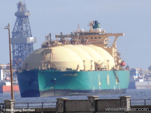
Find the position of the vessel Lng Akwa Ibom on the map. The latter are known coordinates and path.
marine traffic ship tracker show on live map
The current position of vessel Lng Akwa Ibom is -3.36697 lat / -10.4262 lng. Updated: 2025-07-15 09:31:24 UTCCurrently sailing under the flag of Bermuda
Lng Akwa Ibom built in 2004 year
Deadweight:
79633 tDetails:
Last coordinates of the vessel:
UTC, -3.71517, -10.409, course: 6, speed: 7UTC, -3.60317, -10.4156, course: 6, speed: 7
UTC, -3.44005, -10.4248, course: 8, speed: 7.3
2025-07-15 09:31:24 UTC, -3.36697, -10.4262, course: 11, speed: 7.3
The ship also appears on the maps: