vessel ATILA IMO: 9262754, Crude Oil Tanker vesseltracker.com
Vessel ATILA IMO: 9262754, Crude Oil Tanker
MMSI: 613769400 callsign: TJM0033 size: 60x333

Find the position of the vessel ATILA on the map. The latter are known coordinates and path.

marine traffic ship tracker show on live map

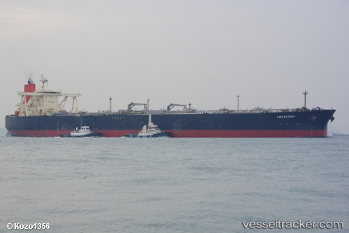
The current position of vessel ATILA is 17.2201 lat / 66.1176 lng. Updated: 2024-04-27 17:22:29 UTC

Currently sailing under the flag of Cameroon

ATILA built in 2003 year

Deadweight:
300667 t

Payload_mass:
300667 tonne
Gross tonnage:
159960
Service entry:
2003-01-01T00:00:00Z
Details:


Last coordinates of the vessel:
UTC, 16.8501, 66.4213, course: 321, speed: 12.8
UTC, 17.0654, 66.2538, course: 319, speed: 12.6
UTC, 17.122, 66.2053, course: 314, speed: 12.5
2024-04-27 17:22:29 UTC, 17.2201, 66.1176, course: 319, speed: 12.6


Most frequent ports a vessels calls at ATILA (613769400):

Sambu, traffic: 7
Singapore, traffic: 5
Malacca, traffic: 2
Ta-Ku, traffic: 1
Porto Grande, traffic: 1

Link to the map:


Find another ship

ATILA (613769400) last ports (portcalls and passsages)

Sambu | 2024-04-19 02:14:37
Malacca | 2024-03-22 01:22:52
Malacca | 2023-11-22 14:09:15
Singapore | 2023-09-24 20:29:52
Sambu | 2023-07-09 01:54:43
Singapore | 2023-07-03 09:56:04
Singapore | 2023-05-06 15:20:50
Sambu | 2023-04-24 16:55:47
Singapore | 2023-04-24 10:23:44
Singapore | 2023-04-20 10:23:19
Porto Grande | 2022-07-11 16:12:20
Ta-Ku | 2022-01-05 04:30:51