 vesseltracker.com
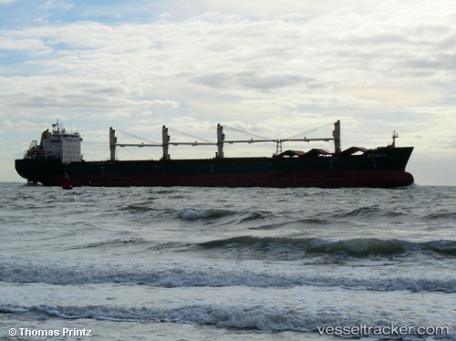
 BLUEBILL
Current Status
Where is the vessel?
BLUEBILL is currently in Near TYNE, based on AIS data received about 1h ago.
Latest AIS update:
Current position: 54.98676° N, 1.45018° W (Near TYNE)
Average speed (last 7 days): Loading…
Average speed (last 30 days): Loading…
Vessel profile: BLUEBILL is a Bulk Carrier with dimensions m x m.
This page combines live AIS, route history, probable destination signals, nearby traffic, and port activity for practical vessel monitoring.
The current position of vessel BLUEBILL is 54.98676 lat / -1.45018 lng. Updated: 2026-03-26 03:27:38 UTCNearest reference points:
- Near TYNE
- Near Blyth
- Near North Berwick
Currently sailing under the flag of Marshall Islands ![]()
Details:
Live Vessel BLUEBILL Analytics (details, animations, etc.)
Recent AIS points (UTC):
2026-03-25 21:24:19 UTC · 54.98678, -1.45021 · SOG 0 kn · COG 254°2026-03-26 00:12:14 UTC · 54.98676, -1.45020 · SOG 0 kn · COG 255°
2026-03-26 02:00:17 UTC · 54.98672, -1.45020 · SOG 0.1 kn · COG 254°
2026-03-26 03:27:38 UTC · 54.98676, -1.45018 · SOG 0 kn · COG -1°