vessel Kareem IMO: 9266097, Bulk Carrier
vesseltracker.com
Vessel Kareem IMO: 9266097, Bulk Carrier
MMSI: 525120006 callsign: YBVO2 size: 32x189

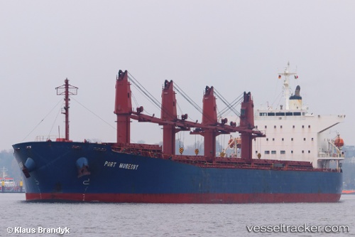
Find the position of the vessel Kareem on the map. The latter are known coordinates and path.

marine traffic ship tracker show on live map

The current position of vessel Kareem is -4.96311 lat / 136.714 lng. Updated: 2024-05-06 07:21:38 UTC
Payload_mass:
53553 tonne
Gross tonnage:
29980
Service entry:
2002-01-01T00:00:00Z
Details:


Last coordinates of the vessel:
UTC, -4.96419, 136.713, course: 299, speed: 0.5
UTC, -4.96311, 136.714, course: 269, speed: 0.2
2024-05-06 07:21:38 UTC, -4.96311, 136.714, course: 269, speed: 0.2


Most frequent ports a vessels calls at Kareem (525120006):

Taboneo, traffic: 10
Muara Pantai, traffic: 5
Makassar, traffic: 4
Lingkas, traffic: 3
Balikpapan, traffic: 1

Link to the map:


Find another ship

Kareem (525120006) last ports (portcalls and passsages)

Balikpapan | 2024-02-23 08:47:38
Makassar | 2024-02-06 03:17:26
Muara Pantai | 2024-01-17 02:38:37
Senipah Oil Terminal | 2024-01-05 07:28:16
Senipah Oil Terminal | 2024-01-01 07:21:53
Senipah Oil Terminal | 2023-12-13 03:31:19
Makassar | 2023-11-07 20:11:39
Taboneo | 2023-11-02 08:15:52
Taboneo | 2023-10-29 07:05:41
Taboneo | 2023-10-25 07:58:42
Muara Pantai | 2023-10-12 09:43:23
Muara Pantai | 2023-10-07 11:32:03
Muara Pantai | 2023-10-03 11:29:34
Muara Pantai | 2023-09-29 09:56:56
Taboneo | 2023-09-20 03:24:05
Taboneo | 2023-09-16 02:22:35
Makassar | 2023-08-09 14:29:46
Taboneo | 2023-08-07 13:39:23
Taboneo | 2023-08-03 12:11:43
Taboneo | 2023-07-30 11:37:17
Taboneo | 2023-07-15 18:48:38
Taboneo | 2023-07-11 18:17:37
Lingkas | 2023-04-03 07:31:00
Lingkas | 2023-03-30 07:11:08
Lingkas | 2023-03-26 05:00:58
Makassar | 2022-02-07 11:23:18