 vesseltracker.com
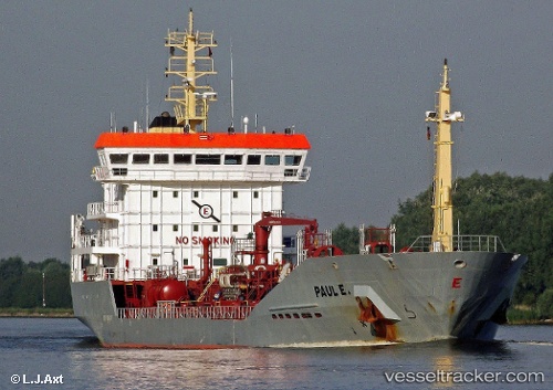
Find the position of the vessel Paul E on the map. The latter are known coordinates and path.
marine traffic ship tracker show on live map
The current position of vessel Paul E is 51.9174 lat / 4.21527 lng. Updated: 2024-04-29 21:38:13 UTCCurrently sailing under the flag of Gibraltar
Paul E built in 2005 year
Port of registry:
Gibraltar (British Overseas Territory)Speed:
14 knotDeadweight:
6974 tPayload_mass:
6974.4 tonneGross tonnage:
4677Service entry:
2005-01-01T00:00:00ZDetails:
Last coordinates of the vessel:
UTC, 51.9174, 4.21523, course: 359, speed: 0.1UTC, 51.9174, 4.21518, course: 358, speed: 0.1
UTC, 51.9174, 4.21523, course: 358, speed: 0.1
2024-04-29 21:38:13 UTC, 51.9174, 4.21527, course: 359, speed: 0.1