vessel Neptune IMO: 9278131, Fish Carrier
vesseltracker.com
Vessel Neptune IMO: 9278131, Fish Carrier
MMSI: 250493000 callsign: EIGN size: 40x13

Find the position of the vessel Neptune on the map. The latter are known coordinates and path.

marine traffic ship tracker show on live map

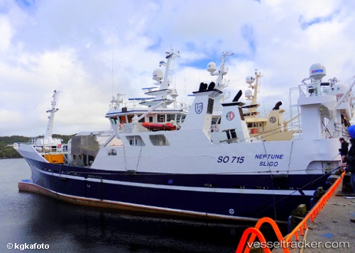
The current position of vessel Neptune is 54.6283 lat / -8.43667 lng. Updated: 2024-04-28 16:22:33 UTC

Currently sailing under the flag of Ireland

Neptune built in 2003 year

Deadweight:
800 t

Gross tonnage:
798
Service entry:
2003-01-01T00:00:00Z
Details:


Last coordinates of the vessel:
UTC, 54.6283, -8.43667, course: -1, speed: 0
2024-04-28 16:22:33 UTC, 54.6283, -8.43667, course: -1, speed: 0


Most frequent ports a vessels calls at Neptune (250493000):

Alesund, traffic: 7
Lerwick, traffic: 4
Pentland Firth, traffic: 2
Skagens Odde, traffic: 2
Stornoway, traffic: 1
Inishtrahull, traffic: 1

Link to the map:


Find another ship

Neptune (250493000) last ports (portcalls and passsages)

Alesund | 2024-02-23 19:42:22
Alesund | 2024-02-17 13:12:10
Alesund | 2024-02-13 12:00:06
Alesund | 2024-02-07 21:17:30
Lerwick | 2024-02-06 18:32:14
Lerwick | 2024-02-02 18:25:50
Alesund | 2024-01-31 00:02:28
Pentland Firth | 2023-08-18 04:23:23
Skagens Odde | 2023-08-16 13:19:28
Skagens Odde | 2023-04-16 21:08:38
Pentland Firth | 2023-04-15 00:30:35
Lerwick | 2023-02-16 02:25:37
Alesund | 2023-02-14 06:00:57
Stornoway | 2023-01-28 17:17:21
Lerwick | 2023-01-26 23:39:29
Alesund | 2023-01-24 23:38:42
Inishtrahull | 2022-02-12 10:35:05