 vesseltracker.com
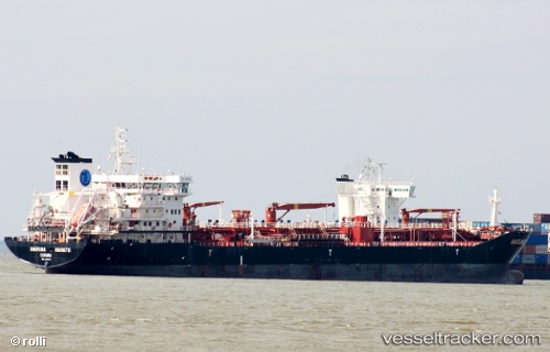
 TITAN HARMONY
Current Status
Where is the vessel?
TITAN HARMONY is currently in Near Sharjah, based on AIS data received about 3h ago.
Latest AIS update:
Current position: 25.43347° N, 55.28955° E (Near Sharjah)
Average speed (last 7 days): Loading…
Average speed (last 30 days): Loading…
Vessel profile: TITAN HARMONY is a Oil/Chemical Tanker with dimensions m x m.
This page combines live AIS, route history, probable destination signals, nearby traffic, and port activity for practical vessel monitoring.
The current position of vessel TITAN HARMONY is 25.43347 lat / 55.28955 lng. Updated: 2026-03-25 07:30:20 UTCNearest reference points:
- Near Sharjah
- Near Mina Khalid
- Near AJMAN
Currently sailing under the flag of Barbados ![]()
Details:
Live Vessel TITAN HARMONY Analytics (details, animations, etc.)
Recent AIS points (UTC):
2026-03-25 01:35:43 UTC · 25.43510, 55.29157 · SOG 0.1 kn · COG 165°2026-03-25 03:35:45 UTC · 25.43433, 55.29046 · SOG 0 kn · COG 110°
2026-03-25 05:42:19 UTC · 25.43405, 55.29019 · SOG 0 kn · COG 111°
2026-03-25 07:30:20 UTC · 25.43347, 55.28955 · SOG 0 kn · COG 107°