vessel Baut IMO: 9287041, Tug
vesseltracker.com
Vessel Baut IMO: 9287041, Tug
MMSI: 258196000 callsign: LMJY size: 41x40

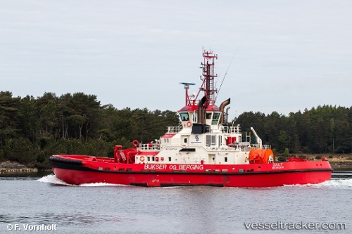
Find the position of the vessel Baut on the map. The latter are known coordinates and path.

marine traffic ship tracker show on live map

The current position of vessel Baut is 60.8138 lat / 5.01622 lng. Updated: 2024-05-07 07:04:32 UTC

Currently sailing under the flag of Norway

Baut built in 2003 year

Gross tonnage:
741
Service entry:
2003-01-01T00:00:00Z

Manufacturer:
Moen Marin (Norwegian shipyard)
Details:


Last coordinates of the vessel:
UTC, 60.8138, 5.01622, course: 57, speed: 0
2024-05-07 07:04:32 UTC, 60.8138, 5.01622, course: 57, speed: 0


Most frequent ports a vessels calls at Baut (258196000):

Moss, traffic: 4
Hakonsvern, traffic: 4
Horten, traffic: 4
Bergen, traffic: 3
Slagen, traffic: 2
Mandal, traffic: 2
Risor, traffic: 1
Tonsberg, traffic: 1
Arendal, traffic: 1
Egersund, traffic: 1
Larvik, traffic: 1

Link to the map:


Find another ship

Baut (258196000) last ports (portcalls and passsages)

Bergen | 2023-12-21 18:40:49
Hakonsvern | 2023-12-21 18:18:49
Mandal | 2023-12-20 17:55:19
Arendal | 2023-12-20 13:29:59
Risor | 2023-12-20 11:48:54
Larvik | 2023-12-20 09:33:43
Tonsberg | 2023-12-20 07:25:48
Slagen | 2023-12-20 06:35:22
Moss | 2023-12-17 09:10:35
Moss | 2023-12-13 08:55:12
Moss | 2023-12-09 08:44:14
Moss | 2023-12-05 08:26:39
Slagen | 2023-12-05 07:08:30
Mandal | 2023-12-03 20:06:10
Egersund | 2023-12-03 13:57:18
Hakonsvern | 2023-12-02 22:40:09
Hakonsvern | 2022-08-30 19:20:43
Hakonsvern | 2022-08-26 19:18:24