 vesseltracker.com
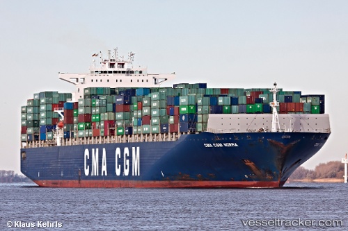
 CMA CGM NORMA
Current Status
Where is the vessel?
CMA CGM NORMA is currently in 169 nm W of Sebang, based on AIS data received about 3h ago.
Latest AIS update:
Current position: 6.22667° N, 92.49670° E (169 nm W of Sebang)
Average speed (last 7 days): Loading…
Average speed (last 30 days): Loading…
Vessel profile: CMA CGM NORMA is a Container Ship with dimensions 349m x 349m.
This page combines live AIS, route history, probable destination signals, nearby traffic, and port activity for practical vessel monitoring.
The current position of vessel CMA CGM NORMA is 6.22667 lat / 92.4967 lng. Updated: 2026-03-26 03:52:59 UTCNearest reference points:
- 160 nm W of Sebang
- 172 nm W of LHOKNGA
- 80 nm W of Sebang
Currently sailing under the flag of Malta ![]()
CMA CGM NORMA built in 2006 year
Deadweight:
113909 tDetails:
Live Vessel CMA CGM NORMA Analytics (details, animations, etc.)
Recent AIS points (UTC):
2026-03-25 21:55:01 UTC · 6.31667, 94.25830 · SOG 18 kn · COG -1°2026-03-26 00:01:23 UTC · 6.28333, 93.64670 · SOG 17 kn · COG -1°
2026-03-26 01:46:36 UTC · 6.26333, 93.09500 · SOG 18 kn · COG -1°
2026-03-26 03:52:59 UTC · 6.22667, 92.49670 · SOG 17 kn · COG -1°