vessel '538009382' IMO: 9310135, vesseltracker.com
Vessel '538009382' IMO: 9310135,
MMSI: 538009382 callsign: size: x

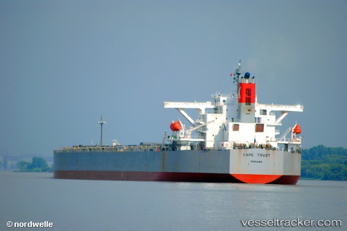
Find the position of the vessel '538009382' on the map. The latter are known coordinates and path.

marine traffic ship tracker show on live map

The current position of vessel '538009382' is 36.4648 lat / -1.63378 lng. Updated: 2024-05-05 10:49:51 UTC
Payload_mass:
176925 tonne
Gross tonnage:
89728
Beam:
45 metre
Service entry:
2006-01-01T00:00:00Z

Manufacturer:
Namura Shipbuilding
Details:


Last coordinates of the vessel:
UTC, 36.3047, -2.70278, course: 84, speed: 13
UTC, 36.3328, -2.31667, course: 66, speed: 12.6
UTC, 36.4515, -1.71412, course: 80, speed: 13
2024-05-05 10:49:51 UTC, 36.4648, -1.63378, course: 80, speed: 13.1


Most frequent ports a vessels calls at '538009382' (538009382):

Whyalla, traffic: 4
Dampier, traffic: 3
Sambu, traffic: 3
Selat Lombok, traffic: 3
Singapore, traffic: 3
Richards Bay, traffic: 2
Vancouver, traffic: 1
Victoria, traffic: 1
Hong Kong, traffic: 1
Lianyungang, traffic: 1
Wu-Sung, traffic: 1
Port Walcot, traffic: 1
Wusong, traffic: 1
Samson Point, traffic: 1
Selat Sunda, traffic: 1

Link to the map:


Find another ship

'538009382' (538009382) last ports (portcalls and passsages)

Richards Bay | 2023-12-28 06:22:00
Richards Bay | 2023-12-19 21:17:15
Victoria | 2023-01-01 02:46:09
Vancouver | 2022-12-28 02:12:44
Lianyungang | 2022-11-04 06:01:37
Whyalla | 2022-09-30 19:52:08
Whyalla | 2022-09-26 19:44:38
Selat Lombok | 2022-09-16 05:06:35
Dampier | 2022-08-14 01:17:57
Singapore | 2022-08-01 01:04:08
Hong Kong | 2022-07-24 22:38:28
Selat Sunda | 2022-06-27 10:10:38
Whyalla | 2022-06-09 08:01:28
Whyalla | 2022-06-05 07:38:29
Wusong | 2022-05-13 14:00:38
Samson Point | 2022-04-18 12:56:11
Selat Lombok | 2022-04-10 00:21:56
Dampier | 2022-02-20 03:07:29
Sambu | 2022-01-10 21:35:29
Singapore | 2022-01-10 20:35:59