 vesseltracker.com
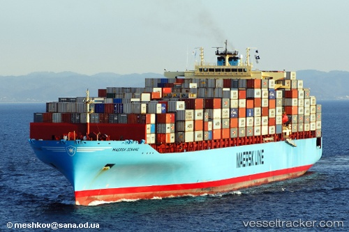
Find the position of the vessel Maersk Senang on the map. The latter are known coordinates and path.
marine traffic ship tracker show on live map
The current position of vessel Maersk Senang is 37.2874 lat / -17.7956 lng. Updated: 2024-05-08 02:39:14 UTCCurrently sailing under the flag of Singapore
Maersk Senang built in 2007 year
Deadweight:
81094 tGross tonnage:
79702Service entry:
2007-01-01T00:00:00ZManufacturer:
Hyundai Heavy Industries (company)
Details:
Last coordinates of the vessel:
UTC, 37.395, -18.5333, course: -1, speed: 13UTC, 37.395, -18.5333, course: -1, speed: 13
UTC, 37.3314, -18.1083, course: 101, speed: 13.3
2024-05-08 02:39:14 UTC, 37.2874, -17.7956, course: 100, speed: 13.3