 vesseltracker.com
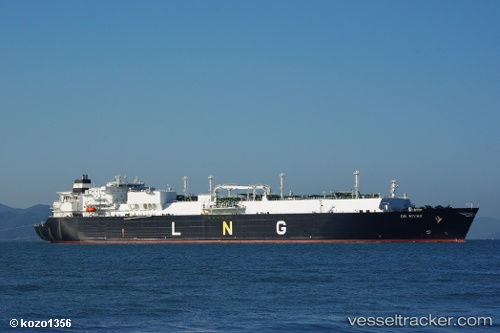
 OB RIVER
Current Status
Where is the vessel?
OB RIVER is currently in 91 nm E of Kikaishima, based on AIS data received about 1h ago.
Latest AIS update:
Current position: 28.76667° N, 131.63499° E (91 nm E of Kikaishima)
Average speed (last 7 days): Loading…
Average speed (last 30 days): Loading…
Vessel profile: OB RIVER is a LNG Tanker with dimensions 288m x 44m.
This page combines live AIS, route history, probable destination signals, nearby traffic, and port activity for practical vessel monitoring.
The current position of vessel OB RIVER is 28.76667 lat / 131.63499 lng. Updated: 2026-03-25 15:47:36 UTCNearest reference points:
- 107 nm NE of Kitadaito Apt
- Near YAMAGAWA
- 71 nm SW of Taniyama
Currently sailing under the flag of Marshall Islands ![]()
OB RIVER built in 2007 year
Deadweight:
84682 tDetails:
Live Vessel OB RIVER Analytics (details, animations, etc.)
Recent AIS points (UTC):
2026-03-25 09:20:38 UTC · 29.43333, 132.81332 · SOG 11 kn · COG -1°2026-03-25 11:45:58 UTC · 29.17386, 132.36948 · SOG 11.3 kn · COG -1°
2026-03-25 13:32:41 UTC · 28.99500, 132.04333 · SOG 11 kn · COG -1°
2026-03-25 15:47:36 UTC · 28.76667, 131.63499 · SOG 11 kn · COG -1°