 vesseltracker.com
Find the position of the vessel Queen B on the map. The latter are known coordinates and path.
marine traffic ship tracker show on live map
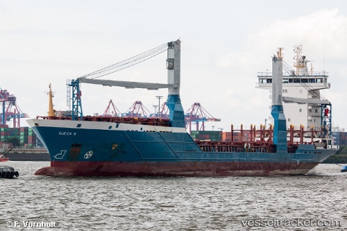
The current position of vessel Queen B is 24.7702 lat / -90.4534 lng. Updated: 2024-05-05 06:01:45 UTCCurrently sailing under the flag of Cyprus
Queen B built in 2004 year
Port of registry:
Limassol (city in the Limassol District, Cyprus)Deadweight:
8223 tPayload_mass:
8061 tonneGross tonnage:
6734Service entry:
2004-01-01T00:00:00ZDetails:
Last coordinates of the vessel:
UTC, 25.6162, -88.0938, course: 246, speed: 14.8UTC, 24.7702, -90.4534, course: 246, speed: 15.7
UTC, 24.7702, -90.4534, course: 246, speed: 15.7
2024-05-05 06:01:45 UTC, 24.7702, -90.4534, course: 246, speed: 15.7