 vesseltracker.com
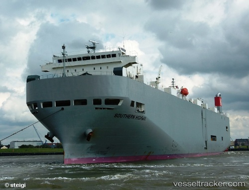
Southern Highway
Current StatusWhere is the vessel?
Southern Highway is currently in 109 nm SW of Geraldton, based on AIS data received about 1h ago.
Latest AIS update:
Current position: 29.72667° S, 112.80625° E (109 nm SW of Geraldton)
Average speed (last 7 days): Loading…
Average speed (last 30 days): Loading…
Vessel profile: Southern Highway is a Vehicles Carrier with dimensions 28m x 188m.
This page combines live AIS, route history, probable destination signals, nearby traffic, and port activity for practical vessel monitoring.
The current position of vessel Southern Highway is -29.72667 lat / 112.80625 lng. Updated: 2026-03-26 03:27:25 UTCNearest reference points:
- 45 nm W of Cataby
Details:
Live Vessel Southern Highway Analytics (details, animations, etc.)
Recent AIS points (UTC):
2026-03-25 21:30:53 UTC · -31.16590, 113.55941 · SOG 16.5 kn · COG 347°2026-03-26 00:20:35 UTC · -30.45491, 113.25036 · SOG 16.2 kn · COG 335°
2026-03-26 01:19:20 UTC · -30.21689, 113.11664 · SOG 15.9 kn · COG 336°
2026-03-26 03:27:25 UTC · -29.72667, 112.80625 · SOG 15.3 kn · COG 326°