 vesseltracker.com
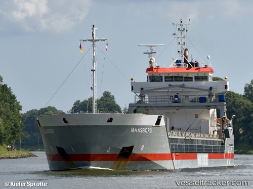
Find the position of the vessel Maasborg on the map. The latter are known coordinates and path.
marine traffic ship tracker show on live map
The current position of vessel Maasborg is 53.9856 lat / 8.4156 lng. Updated: 2024-04-30 04:02:15 UTCCurrently sailing under the flag of Netherlands
Maasborg built in 2005 year
Port of registry:
Delfzijl (city and former municipality in Groningen, Netherlands)Speed:
14.4 knotDeadweight:
6000 tPayload_mass:
6000 tonneGross tonnage:
3990Service entry:
2005-01-01T00:00:00ZManufacturer:
Ferus Smit (shipyard in Westerbroek, Netherlands).jpg)
Details:
Last coordinates of the vessel:
UTC, 54.14, 9.34178, course: 218, speed: 6.5UTC, 53.933, 9.21134, course: 217, speed: 6.8
UTC, 53.8449, 8.90733, course: 259, speed: 9.4
2024-04-30 04:02:15 UTC, 53.9856, 8.4156, course: 280, speed: 13.7