 vesseltracker.com
Find the position of the vessel Karl Jakob K on the map. The latter are known coordinates and path.
marine traffic ship tracker show on live map
The current position of vessel Karl Jakob K is 42.399 lat / -8.70118 lng. Updated: 2024-05-02 09:47:18 UTCCurrently sailing under the flag of Netherlands
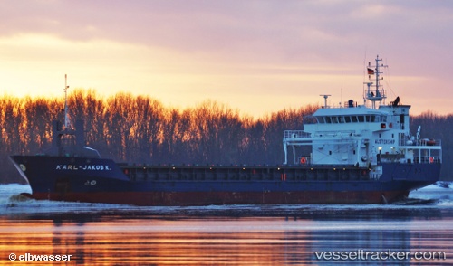
Karl Jakob K built in 2006 year
Port of registry:
Delfzijl (city and former municipality in Groningen, Netherlands)Deadweight:
4264 tPayload_mass:
4264 tonneGross tonnage:
3057Beam:
15.2 metreService entry:
2006-01-01T00:00:00ZManufacturer:
Ruse ShipyardDetails:
Last coordinates of the vessel:
UTC, 42.3989, -8.70125, course: 188, speed: 0UTC, 42.3988, -8.70118, course: 188, speed: 0
UTC, 42.3989, -8.70121, course: 188, speed: 0
2024-05-02 09:47:18 UTC, 42.399, -8.70118, course: 188, speed: 0