 vesseltracker.com
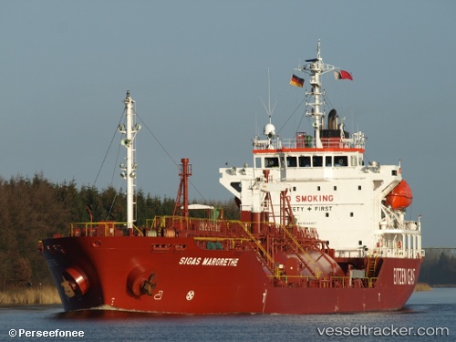
Find the position of the vessel B Gas Margrethe on the map. The latter are known coordinates and path.
marine traffic ship tracker show on live map
The current position of vessel B Gas Margrethe is 57.5496 lat / 11.6677 lng. Updated: 2024-05-02 13:26:25 UTCCurrently sailing under the flag of Malta
B Gas Margrethe built in 2006 year
Port of registry:
Valletta (capital of Malta)Deadweight:
4970 tPayload_mass:
4970 tonneGross tonnage:
4253Service entry:
2006-01-01T00:00:00ZDetails:
Last coordinates of the vessel:
UTC, 57.5499, 11.6675, course: 92, speed: 0UTC, 57.5498, 11.6675, course: 86, speed: 0
UTC, 57.5499, 11.6675, course: 91, speed: 0.1
2024-05-02 13:26:25 UTC, 57.5496, 11.6677, course: 77, speed: 0.1