 vesseltracker.com
Find the position of the vessel Salih Reis 4 on the map. The latter are known coordinates and path.
marine traffic ship tracker show on live map
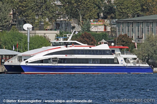
The current position of vessel Salih Reis 4 is 40.8776 lat / 28.8057 lng. Updated: 2024-05-05 15:04:41 UTCCurrently sailing under the flag of Turkey
Salih Reis 4 built in 2007 year
Port of registry:
Istanbul (city in Turkey located at the Bosporus Strait)Deadweight:
50 tPayload_mass:
50 tonneGross tonnage:
644Service entry:
2007-01-01T00:00:00ZDetails:
Last coordinates of the vessel:
UTC, 40.7166, 28.452, course: 48, speed: 24.7UTC, 40.8936, 28.7359, course: 58, speed: 24.7
UTC, 40.9915, 29.0181, course: 178, speed: 0
2024-05-05 15:04:41 UTC, 40.8776, 28.8057, course: 231, speed: 24.8