 vesseltracker.com
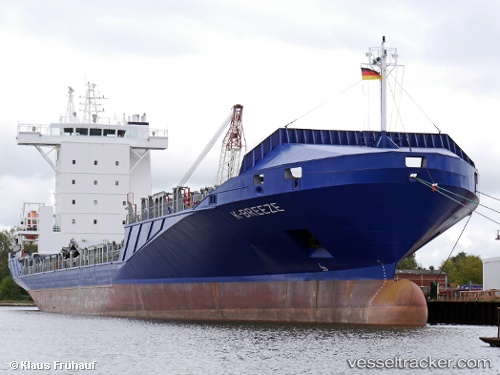
Find the position of the vessel K breeze on the map. The latter are known coordinates and path.
marine traffic ship tracker show on live map
The current position of vessel K breeze is 15.8327 lat / -87.9656 lng. Updated: 2024-05-05 10:28:56 UTCCurrently sailing under the flag of Antigua Barbuda
K breeze built in 2008 year
Port of registry:
Saint John's (capital city of Antigua and Barbuda)Deadweight:
11181 tPayload_mass:
11181.9 tonneGross tonnage:
8246Service entry:
2008-01-01T00:00:00ZManufacturer:
Rolandwerft (Shipyard in Warfleth an der Unterweser, which belongs to Berne)Details:
Last coordinates of the vessel:
UTC, 15.9458, -88.3654, course: 96, speed: 8.8UTC, 15.9039, -88.1115, course: 99, speed: 7.2
UTC, 15.8328, -87.968, course: 162, speed: 2.9
2024-05-05 10:28:56 UTC, 15.8327, -87.9656, course: 127, speed: 0.6