 vesseltracker.com
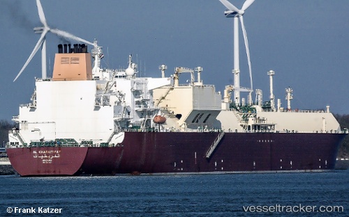
Find the position of the vessel Al Kharaitiyat on the map. The latter are known coordinates and path.
marine traffic ship tracker show on live map
The current position of vessel Al Kharaitiyat is 6.44666 lat / 108.165 lng. Updated: 2024-05-04 07:29:10 UTCCurrently sailing under the flag of Marshall Is
Al Kharaitiyat built in 2009 year
Deadweight:
107153 tGross tonnage:
136168Service entry:
2009-01-01T00:00:00ZManufacturer:
Hanwha Ocean (shipbuilder of South Korea)Details:
Last coordinates of the vessel:
UTC, 5.985, 107.647, course: -1, speed: 14UTC, 6.19833, 107.872, course: -1, speed: 14
UTC, 6.352, 108.053, course: 50, speed: 13.8
2024-05-04 07:29:10 UTC, 6.44666, 108.165, course: -1, speed: 14
The ship also appears on the maps: