vessel '538009462' IMO: 9405071, vesseltracker.com
Vessel '538009462' IMO: 9405071,
MMSI: 538009462 callsign: size: x

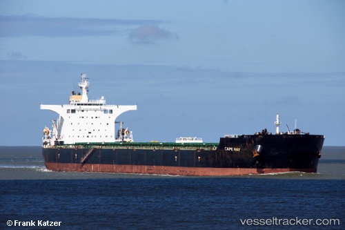
Find the position of the vessel '538009462' on the map. The latter are known coordinates and path.

marine traffic ship tracker show on live map

The current position of vessel '538009462' is 13.465 lat / 113.423 lng. Updated: 2024-05-02 17:25:00 UTC
Port of registry:
Majuro (coral atoll, capital of the Marshall Islands)
Speed:
15 knot
Payload_mass:
177000 tonne
Gross tonnage:
91373
Operator:
Columbia Shipmanagement (company in Hamburg, Germany)
Service entry:
2007-01-01T00:00:00Z

Manufacturer:
Shanghai Waigaoqiao Shipbuilding
Details:


Last coordinates of the vessel:
UTC, 13.8617, 113.742, course: -1, speed: 13
UTC, 13.8067, 113.698, course: -1, speed: 14
UTC, 13.5667, 113.507, course: -1, speed: 14
2024-05-02 17:25:00 UTC, 13.465, 113.423, course: -1, speed: 14


Most frequent ports a vessels calls at '538009462' (538009462):

Sambu, traffic: 3
Vishakhapatnam, traffic: 3
Gelibolu, traffic: 2
Port Said, traffic: 2
Richards Bay, traffic: 2
Uskudar, traffic: 2
Bur Ibrahim, traffic: 2
Canakkale, traffic: 2
Istanbul, traffic: 1
Paradip, traffic: 1
Port Louis, traffic: 1
Port Elizabeth, traffic: 1

Link to the map:


Find another ship

'538009462' (538009462) last ports (portcalls and passsages)

Sambu | 2022-12-29 08:36:12
Port Louis | 2022-09-19 22:53:14
Port Elizabeth | 2022-08-01 10:23:34
Paradip | 2022-06-21 13:11:11
Vishakhapatnam | 2022-06-16 04:11:07
Vishakhapatnam | 2022-06-12 04:02:37
Vishakhapatnam | 2022-04-12 18:50:12
Richards Bay | 2022-02-07 16:02:47
Sambu | 2021-12-28 07:40:41
Bur Ibrahim | 2021-12-07 16:55:10
Port Said | 2021-12-07 07:25:19
Canakkale | 2021-12-04 10:20:02
Gelibolu | 2021-12-04 08:20:01
Uskudar | 2021-12-01 07:50:05