 vesseltracker.com
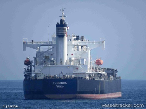
Find the position of the vessel FLORINDA on the map. The latter are known coordinates and path.
marine traffic ship tracker show on live map
The current position of vessel FLORINDA is -9.535 lat / 75.5067 lng. Updated: 2024-04-29 04:31:56 UTCPayload_mass:
58791 tonneGross tonnage:
32415Service entry:
2008-01-01T00:00:00ZManufacturer:
Tsuneishi ShipbuildingDetails:
Last coordinates of the vessel:
UTC, -9.21333, 75.9017, course: -1, speed: 10UTC, -9.4335, 75.6331, course: 224, speed: 11.1
UTC, -9.47464, 75.5841, course: 227, speed: 11.2
2024-04-29 04:31:56 UTC, -9.535, 75.5067, course: -1, speed: 10