 vesseltracker.com
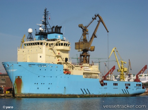
Find the position of the vessel Maersk Launcher on the map. The latter are known coordinates and path.
marine traffic ship tracker show on live map
The current position of vessel Maersk Launcher is -22.4317 lat / -39.965 lng. Updated: 2024-04-28 17:23:38 UTCCurrently sailing under the flag of Denmark
Maersk Launcher built in 2010 year
Port of registry:
Hanstholm (small town at the danish west coast)Deadweight:
2912 tPayload_mass:
2912 tonneGross tonnage:
6798Service entry:
2010-01-01T00:00:00ZManufacturer:
Volkswerft (company)
Details:
Last coordinates of the vessel:
UTC, -22.4312, -39.9667, course: 232, speed: 0.2UTC, -22.4317, -39.965, course: -1, speed: 0
UTC, -22.4317, -39.965, course: -1, speed: 0
2024-04-28 17:23:38 UTC, -22.4317, -39.965, course: -1, speed: 0