 vesseltracker.com
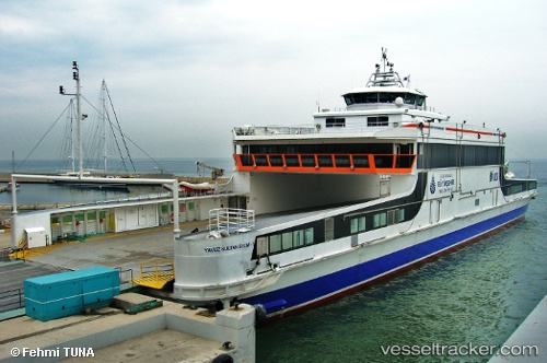
Find the position of the vessel Yavuz Sultan Selim 1 on the map. The latter are known coordinates and path.
marine traffic ship tracker show on live map
The current position of vessel Yavuz Sultan Selim 1 is 41.0015 lat / 28.9585 lng. Updated: 2024-05-18 23:06:49 UTCCurrently sailing under the flag of Turkey
Yavuz Sultan Selim 1 built in 2008 year
Port of registry:
Istanbul (city in Turkey located at the Bosporus Strait)Deadweight:
280 tPayload_mass:
280 tonneGross tonnage:
2284Service entry:
2008-01-01T00:00:00ZDetails:
Last coordinates of the vessel:
UTC, 41.0014, 28.9585, course: 196, speed: 0.2UTC, 41.0015, 28.9585, course: 196, speed: 0
UTC, 41.0014, 28.9586, course: 196, speed: 0.4
2024-05-18 23:06:49 UTC, 41.0015, 28.9585, course: 196, speed: 0