 vesseltracker.com
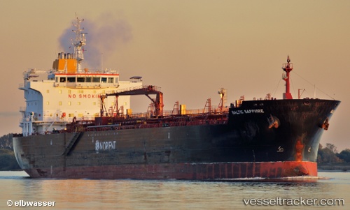
 SAPPHIRE
Current Status
Where is the vessel?
SAPPHIRE is currently in 14 nm S of Southwest Pass, based on AIS data received about 1h ago.
Latest AIS update:
Current position: 28.77184° N, 89.41414° W (14 nm S of Southwest Pass)
Average speed (last 7 days): Loading…
Average speed (last 30 days): Loading…
Vessel profile: SAPPHIRE is a Oil/Chemical Tanker with dimensions m x m.
This page combines live AIS, route history, probable destination signals, nearby traffic, and port activity for practical vessel monitoring.
The current position of vessel SAPPHIRE is 28.77184 lat / -89.41414 lng. Updated: 2026-03-26 05:34:46 UTCNearest reference points:
- Near Pilottown
- 13 nm NE of Pilottown
- Near Port Sulphur
Currently sailing under the flag of Marshall Islands ![]()
Details:
Live Vessel SAPPHIRE Analytics (details, animations, etc.)
Recent AIS points (UTC):
2026-03-25 23:22:39 UTC · 29.70142, -89.97638 · SOG 13 kn · COG 159°2026-03-26 02:19:07 UTC · 29.34923, -89.41062 · SOG 14.7 kn · COG 130°
2026-03-26 03:37:45 UTC · 29.10988, -89.27082 · SOG 13.6 kn · COG 210°
2026-03-26 05:34:46 UTC · 28.77184, -89.41414 · SOG 11.2 kn · COG 144°