vessel 352978216 IMO: 9447378, vesseltracker.com
Vessel 352978216 IMO: 9447378,
MMSI: 352978216 callsign: size: x

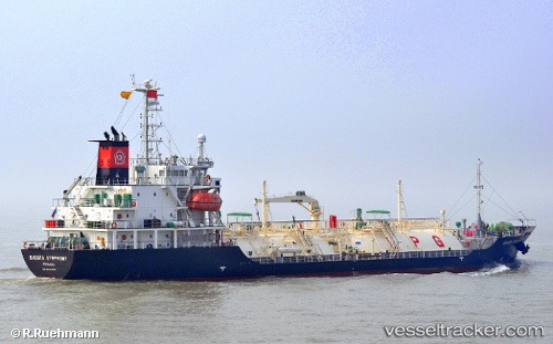
Find the position of the vessel 352978216 on the map. The latter are known coordinates and path.

marine traffic ship tracker show on live map

The current position of vessel 352978216 is 4.365 lat / 109.875 lng. Updated: 2024-05-05 10:40:56 UTC
Port of registry:
Panama City (capital of Panama)
Payload_mass:
3161 tonne
Gross tonnage:
2997
Service entry:
2008-01-01T00:00:00Z
Details:


Last coordinates of the vessel:
UTC, 4.365, 109.875, course: -1, speed: 11
2024-05-05 10:40:56 UTC, 4.365, 109.875, course: -1, speed: 11


Most frequent ports a vessels calls at 352978216 (352978216):

Basuo Gang, traffic: 8
Vung Tau, traffic: 7
Cape St. Jacques, traffic: 7
Nansha, traffic: 3
Map Ta Phut, traffic: 2
Davao, traffic: 1
Hong Kong, traffic: 1
Nha Be, traffic: 1
Qui Nhon, traffic: 1
Zamboanga, traffic: 1
Guangzhou, traffic: 1
Batangas, traffic: 1

Link to the map:


Find another ship

352978216 (352978216) last ports (portcalls and passsages)

Map Ta Phut | 2023-12-29 13:01:55
Nha Be | 2023-12-24 01:48:04
Vung Tau | 2023-12-23 22:58:13
Map Ta Phut | 2023-12-20 07:21:11
Guangzhou | 2023-12-13 07:06:14
Nansha | 2023-12-13 05:14:01
Cape St. Jacques | 2022-12-26 23:29:53
Vung Tau | 2022-12-05 00:09:15
Hong Kong | 2022-11-30 23:15:37
Batangas | 2022-11-22 02:16:36
Basuo Gang | 2022-11-16 17:34:43
Basuo Gang | 2022-11-04 17:37:18
Basuo Gang | 2022-10-21 10:35:35
Basuo Gang | 2022-09-08 22:55:42
Basuo Gang | 2022-08-25 23:01:16
Basuo Gang | 2022-08-07 07:22:33
Vung Tau | 2022-06-18 19:22:21
Vung Tau | 2022-05-18 01:32:40
Zamboanga | 2022-05-14 01:46:59
Davao | 2022-05-11 22:27:22
Qui Nhon | 2022-04-06 00:12:15
Vung Tau | 2022-02-10 09:45:12
Nansha | 2022-02-07 03:52:32
Basuo Gang | 2021-12-01 00:37:44