 vesseltracker.com
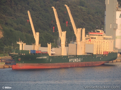
Find the position of the vessel Hyundai Dubai on the map. The latter are known coordinates and path.
marine traffic ship tracker show on live map
The current position of vessel Hyundai Dubai is 35.1941 lat / 128.59 lng. Updated: 2024-05-07 05:31:19 UTCCurrently sailing under the flag of Marshall Is
Hyundai Dubai built in 2011 year
Port of registry:
Majuro (coral atoll, capital of the Marshall Islands)Deadweight:
30104 tPayload_mass:
30104.4 tonneGross tonnage:
23265Service entry:
2011-01-01T00:00:00ZManufacturer:
CSC Jinling (shipyard in Nanjing).jpg)
Details:
Last coordinates of the vessel:
UTC, 35.1941, 128.59, course: 146, speed: 0UTC, 35.1941, 128.59, course: 146, speed: 0
UTC, 35.1941, 128.59, course: 146, speed: 0
2024-05-07 05:31:19 UTC, 35.1941, 128.59, course: 146, speed: 0