 vesseltracker.com
Find the position of the vessel Kea on the map. The latter are known coordinates and path.
marine traffic ship tracker show on live map
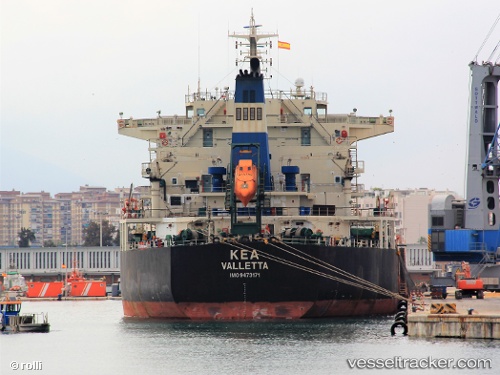
The current position of vessel Kea is 47.2739 lat / -122.439 lng. Updated: 2024-05-06 00:06:52 UTCCurrently sailing under the flag of Malta
Kea built in 2010 year
Port of registry:
Valletta (capital of Malta)Deadweight:
75633 tPayload_mass:
76000 tonneGross tonnage:
41342Service entry:
2010-01-01T00:00:00ZManufacturer:
Jiangnan Shipyard (shipyard)
Details:
Last coordinates of the vessel:
UTC, 47.2733, -122.438, course: -1, speed: 0UTC, 47.2743, -122.44, course: 186, speed: 0.2
UTC, 47.2733, -122.438, course: -1, speed: 0
2024-05-06 00:06:52 UTC, 47.2739, -122.439, course: 219, speed: 0