 vesseltracker.com
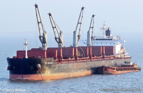
Find the position of the vessel Gillingham on the map. The latter are known coordinates and path.
marine traffic ship tracker show on live map
The current position of vessel Gillingham is 6.53917 lat / 119.964 lng. Updated: 2024-05-03 06:38:30 UTCPort of registry:
Majuro (coral atoll, capital of the Marshall Islands)Payload_mass:
58000 tonneGross tonnage:
32837Operator:
Zeaborn Ship ManagementService entry:
2010-01-01T00:00:00ZManufacturer:
Yangzhou Binjiang Shipbuilding (chinese shipyard)Details:
Last coordinates of the vessel:
UTC, 7.14395, 120.058, course: 184, speed: 11.2UTC, 6.93105, 120.032, course: 188, speed: 11.4
UTC, 6.72833, 120.001, course: 192, speed: 10.6
2024-05-03 06:38:30 UTC, 6.53917, 119.964, course: 190, speed: 10.9