 vesseltracker.com
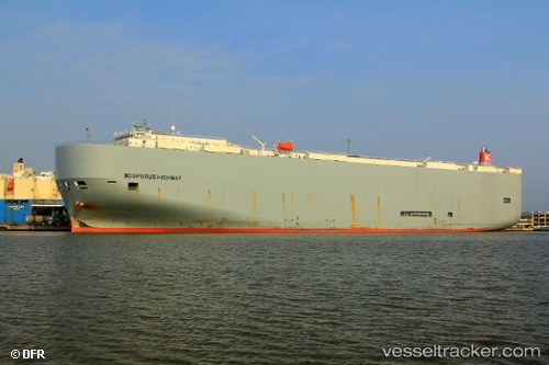
 Bosporus Highway
Current Status
Where is the vessel?
Bosporus Highway is currently in Near Durban, based on AIS data received about 3h ago.
Latest AIS update:
Current position: 29.86896° S, 31.03616° E (Near Durban)
Average speed (last 7 days): Loading…
Average speed (last 30 days): Loading…
Vessel profile: Bosporus Highway is a Vehicles Carrier with dimensions 199m x 199m.
This page combines live AIS, route history, probable destination signals, nearby traffic, and port activity for practical vessel monitoring.
The current position of vessel Bosporus Highway is -29.86896 lat / 31.03616 lng. Updated: 2026-03-25 15:42:21 UTCNearest reference points:
- Near Island View
- Near Durban
- Near Umhlanga Rocks
Currently sailing under the flag of Panama ![]()
Bosporus Highway built in 2009 year
Deadweight:
18792 tDetails:
Live Vessel Bosporus Highway Analytics (details, animations, etc.)
Recent AIS points (UTC):
2026-03-25 09:54:20 UTC · -29.86898, 31.03614 · SOG 0 kn · COG 316°2026-03-25 12:21:20 UTC · -29.86897, 31.03614 · SOG 0 kn · COG 316°
2026-03-25 13:45:22 UTC · -29.86897, 31.03616 · SOG 0 kn · COG -1°
2026-03-25 15:42:21 UTC · -29.86896, 31.03616 · SOG 0 kn · COG 316°